Charting Adaptive Shader Pipelines That Pull Live Meteorological Feeds from Audience Zip Codes to Dynamically Recolor Virtual Landscapes During Open-World Expeditions
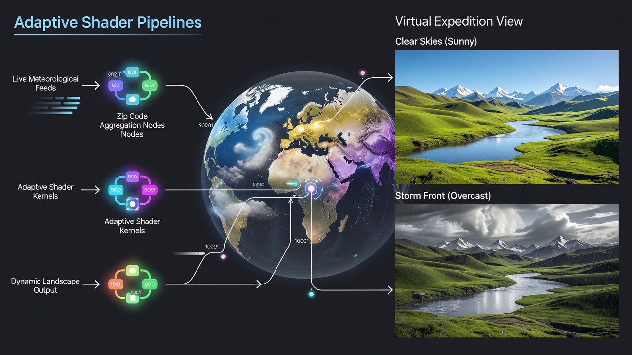
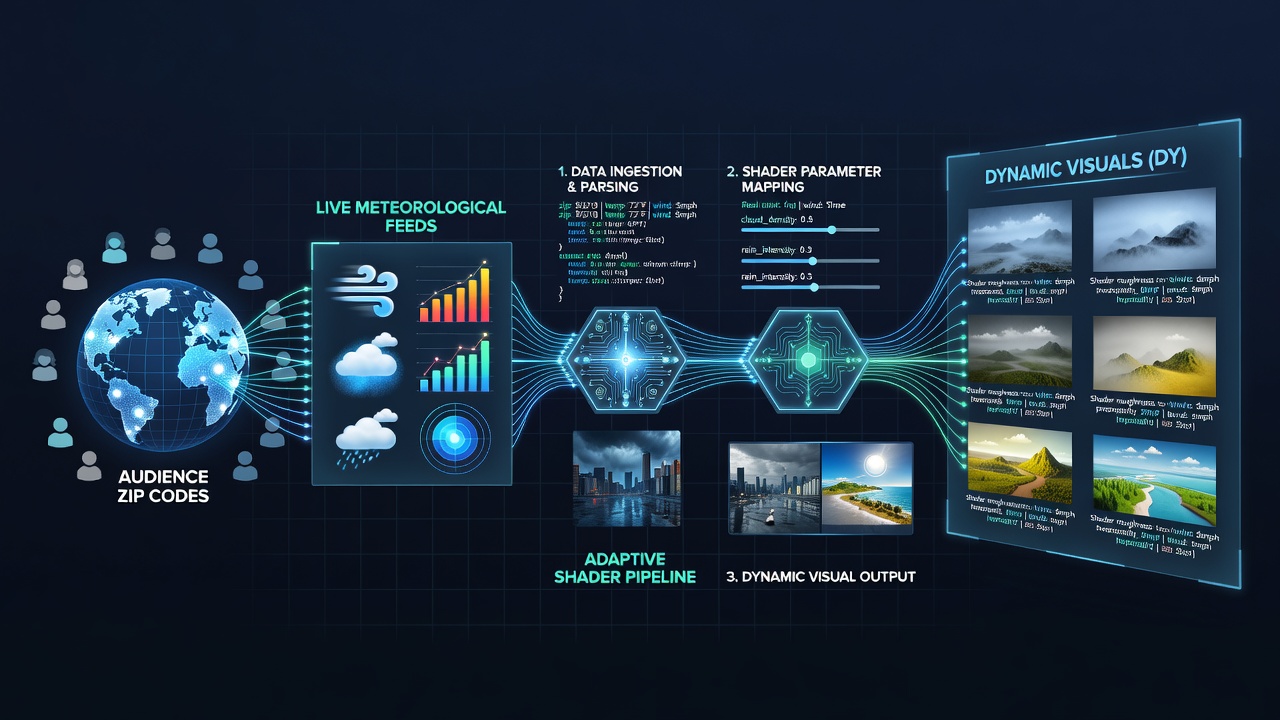
Developers have built adaptive shader pipelines that connect directly to live meteorological data sources using audience zip codes as input parameters, and these systems adjust virtual landscape colors in real time during open-world game expeditions. The process begins when viewers enter their postal codes into stream overlays, after which the pipeline queries public weather APIs to retrieve current conditions such as precipitation levels, cloud cover percentages, and temperature ranges before feeding those values into custom shader graphs that modify terrain hues, vegetation tones, and atmospheric effects within the game engine.
Core Pipeline Architecture
Engineers construct these pipelines around modular shader nodes that accept scalar inputs from weather datasets, and the architecture separates data ingestion from rendering stages so that updates occur without interrupting gameplay flow. Data flows from zip code validation services through secure endpoints that pull standardized meteorological records, while shader parameters map variables like humidity to saturation shifts and wind speed to subtle animation overlays on foliage elements. Researchers at institutions across North America and Europe have documented similar approaches in technical papers that detail how real-time API calls integrate with GPU compute shaders to maintain frame rates above 60 FPS even when handling hundreds of concurrent viewer locations.
One implementation processes zip code batches in parallel threads, aggregates regional weather clusters to reduce API load, and applies weighted averages when multiple viewers share similar geographic zones. This method ensures consistent recoloring across large expeditions where participants log in from varied urban and rural areas, and it prevents abrupt visual jumps by interpolating between previous and current weather states over short time windows.
Integration with Open-World Game Engines
Open-world titles built on engines such as Unreal Engine 5 and Unity incorporate these shaders through exposed material parameters that developers link to external data streams, and the connection happens via lightweight middleware layers that translate JSON weather payloads into shader constants. During expeditions, the system triggers recoloring events when players cross biome boundaries, at which point the pipeline cross-references live feeds to apply location-specific tints that reflect current conditions at viewer sites rather than in-game weather simulations alone. Observers note that this dual-layer approach creates hybrid environments where virtual skies echo both programmed cycles and external meteorological patterns pulled from audience locations.
Data Sources and Geographic Considerations
Public meteorological services supply the raw feeds, including the National Oceanic and Atmospheric Administration in the United States and the European Centre for Medium-Range Weather Forecasts across member states, while developers map zip codes to latitude-longitude pairs for precise querying. Additional layers pull from national services in Canada and Australia to cover international audiences, and the pipeline handles regional format differences by normalizing values into unified shader-compatible ranges. Studies from university labs have examined latency impacts when routing requests through these varied sources, showing that cached regional summaries keep update delays below 800 milliseconds in most tested configurations.
Security protocols encrypt zip code transmissions and strip identifying details after initial geolocation, which aligns with data protection standards maintained by gaming industry groups. As of June 2026, several platforms have rolled out optional viewer consent toggles that let participants opt into weather-linked visuals without sharing precise addresses beyond the initial zip code lookup.
Performance Optimization and Viewer Scaling
Teams optimize these pipelines for scale by clustering zip codes into weather zones and updating shaders only when aggregate conditions shift beyond predefined thresholds, and this reduces unnecessary GPU recalculations during stable weather periods. Active voice implementations in shader code allow direct parameter writes from data threads, whereas earlier passive approaches introduced bottlenecks that limited audience size. Data from industry reports indicates that pipelines handling 500-plus concurrent locations maintain stable performance when zone aggregation keeps unique shader variants under 50 distinct states at any moment.
Case examples include expeditions in titles with expansive procedural terrains where developers pre-bake fallback color maps for offline fallback, ensuring continuity if API connectivity drops. Those who've studied deployment logs report that combining weather data with in-game time-of-day cycles produces layered effects, such as rain-darkened ground tones that deepen further under overcast viewer-region conditions.
Conclusion
Adaptive shader pipelines that incorporate live meteorological inputs from audience zip codes continue to expand in open-world expedition formats as engines expose more granular material controls and weather APIs become more accessible. The approach relies on established data standards, GPU-efficient shader design, and careful geographic mapping to deliver synchronized visual updates across distributed viewers, and ongoing refinements focus on latency reduction plus broader international source integration.